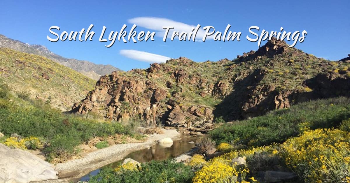
South Lykken Trail Palm Springs is one of those rare hikes that starts almost in the city yet quickly feels wild and quiet.
Tucked against the San Jacinto Mountains, this Palm Springs Lykken Trail has become a go-to for early risers, casual hikers, and even seasoned trekkers who just want a quick but rewarding climb.
The path itself is rocky, a little uneven at times, but never boring, and the views slowly open up as you gain elevation.
What makes it so popular? Well, it strikes a balance that’s hard to beat. It is challenging enough to get your heart pumping, yet accessible enough that you do not need special gear or planning.
You will see locals walking their dogs, tourists chasing sunrise photos, and fitness lovers squeezing in a morning workout before the desert heat kicks in.
And honestly, that contrast between city life and rugged terrain, it is what gives this trail its charm and keeps people coming back again and again.
South Lykken Trail and Lykken Trail Palm Springs Overview
Tucked just above the neighborhoods of Palm Springs, the South Lykken Trail has this quiet, almost understated charm. It doesn’t shout for attention.
Yet once you’re on it, you start to get why locals keep coming back. Within minutes, rocky paths, and wide-open views of the Coachella Valley.
What Is the South Lykken Trail / Lykken Trail in Palm Springs?
The Lykken Trail is a historic route named after Carl Lykken, an early advocate for outdoor life in Palm Springs.
It runs along the foothills of the San Jacinto Mountains and is split into two main sections:
- North Lykken Trail
- South Lykken Trail
The South Lykken Trail starts near Mesquite Avenue and climbs steadily over rocky desert terrain. It connects with the northern section, so you can extend your hike if you’re feeling ambitious.
| Feature | Details |
| Location | Palm Springs, CA 92264, USA |
| Difficulty | Moderate |
| Terrain | Rocky desert trail |
| Best Time | October to April |
It’s not overly polished, and honestly, that’s part of its appeal.
Lichen Trail vs South Lyken Trail: Common Name Confusions Cleared
You’ll often see names like “Lichen Trail” or “South Lyken Trail” floating around. Confusing, right?
Here’s the simple truth:
- “South Lykken Trail” is the correct name
- “Lichen” and “Lyken” are just common misspellings
Once you know this, searching and navigation become much easier.
Why South Lykken Trail Is Among the Best Hikes in Palm Springs CA
So what makes it one of the best hikes in Palm Springs CA? It’s the balance.
- Expansive valley views without extreme elevation
- A steady climb that feels rewarding, not exhausting
- Fewer crowds than popular canyon trails
- Classic desert scenery with native plants
You know what? It doesn’t try to impress. And somehow, that’s exactly why it does.
Still deciding your trip? Read Is Palm Springs Worth a Visit? 7 Stunning Reasons to Go (2026) for inspiration before you hit the trails.
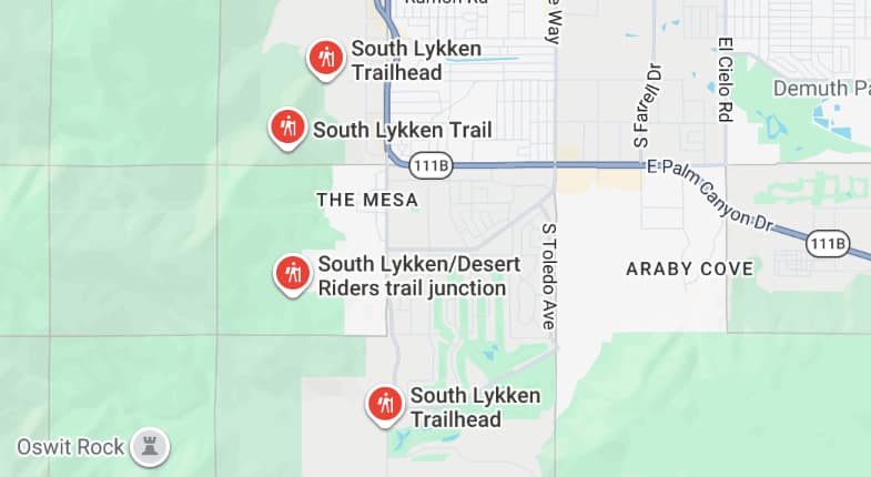
South Lykken Trailhead: Location, Directions and How to Get There
Finding the South Lykken Trailhead is fairly easy, though it can feel a bit hidden at first. It sits right at the edge of a residential area in Palm Springs, which means you go from quiet streets to rugged desert terrain in just a few steps.
It’s simple, unpolished, and that’s exactly what makes it appealing.
South Lykken Trailhead Location in Palm Springs California
The South Lykken Trailhead is located near Mesquite Avenue, just off South Palm Canyon Drive.
There’s no large entrance gate or visitor center, just a marked trail leading into the foothills of the San Jacinto Mountains.
| Feature | Info |
| Address Area | Mesquite Ave, Palm Springs |
| Access Type | Public trail |
| Trail Start | Street-level entry |
It’s easy to reach by car and close to downtown, making it convenient for both locals and visitors.
North Lykken Trailhead and North Lykken Trail Palm Springs Connection
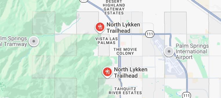
The South Lykken Trail connects directly with the North Lykken Trail, creating a longer hiking route along the mountain base. The North Lykken Trailhead is located near Ramon Road.
Together, they form what many hikers refer to as the North Lykken Loop Trail, though it’s more of a connected route than a perfect loop.
- Continuous trail connection
- Ideal for longer hikes
- Varied elevation and scenery
Getting There: Hiking Trails Near Me Access Tips
If you’re searching for “hiking near me” in Palm Springs, this trail is one of the easiest to access.
- Head south from downtown toward Mesquite Avenue
- Turn toward the mountains
- Look for trail signage and parked cars
Early mornings are best for cooler temperatures and quieter trails.
Parking at South Lykken Trail: Cost, Availability and Rules
One of the best parts? It’s completely free.
- No entry fee
- Free street parking nearby
- No permit required
Just follow the posted parking rules in the neighborhood, and you’re good to go.
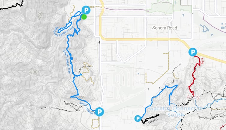
South Lykken Trail Map and Route Navigation Guide
Understanding the South Lykken Trail map before you go makes a real difference. At first glance, it looks simple, but once you’re on the trail, the terrain and junctions can feel a bit less obvious.
A quick mental picture helps. Think of it as a steady climb along the mountain’s edge, with occasional splits that reconnect if you stay generally heading north.
South Lykken Trail Map Overview and Key Junctions
The trail runs parallel to the base of the San Jacinto Mountains, gradually gaining elevation as it moves northward. It’s not heavily marked, so navigation relies on staying on the most worn path.
Here’s what helps:
- Keep the mountains on your left, city on your right
- Watch for subtle trail splits, then rejoin the main path
- Use apps like AllTrails or Google Maps offline for tracking
Honestly, it’s not complicated, but it’s also not a paved park trail. You stay alert, and that’s part of the fun.
Route Description: What the South Lykken Trail Palm Springs Hike Looks Like
The hike begins near Mesquite Avenue with a gentle incline. Within the first 10 minutes, the city views open up behind you.
As you continue:
- The trail becomes rockier with steady switchbacks
- Midway, you’ll notice wider views across the valley
- Further up, the path connects toward North Lykken Trail
Most hikers turn back at their comfort point, making it flexible for different fitness levels.
Trail Details: Distance, Elevation Gain and Difficulty Level
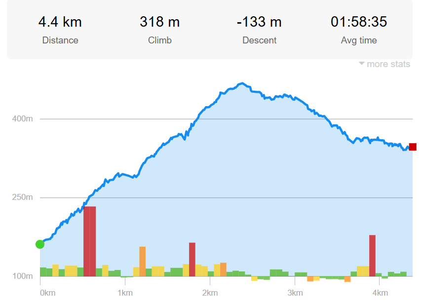
Here’s a quick breakdown to keep things clear:
| Feature | Details |
| Distance | 2.7 miles |
| Elevation Gain | 756 ft |
| Route Type | Out & Back |
| Difficulty | Moderate |
It’s a short hike on paper, but the elevation keeps it interesting. Not too hard, not too easy. Just right.
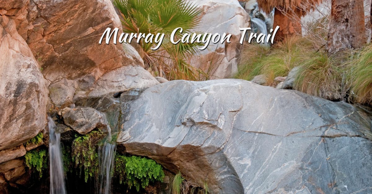
Want another scenic hike? Explore Murray Canyon Trail Guide 2026: Complete Hiking Guide to Seven Sisters Falls for a waterfall-filled adventure.
What to Expect on South Lykken Trail Palm Springs
The South Lykken Trail doesn’t overwhelm you right away. It builds gradually, and that’s part of its appeal.
You begin with a steady incline that feels manageable, but as you climb higher, the views expand, and the city fades into the background. It’s quiet, dry, and unexpectedly calming.
Simonetta Kennett Vista Point and Inspiration Point Palm Springs Views
As you gain elevation, you’ll reach scenic spots like Simonetta Kennett Vista Point and Inspiration Point.
These viewpoints offer:
- Wide, open views across the Coachella Valley
- Clear sightlines over Palm Springs below
- Excellent photo opportunities, especially in early light
Inspiration Point is a natural stopping point. Most hikers pause here, not just for the view, but for the sense of stillness.
Palm Springs Oasis, Desert Flora and Wildlife Along the Trail
The desert may seem sparse at first, but it’s full of life if you look closely.
You’ll notice:
- Creosote bushes, cacti, and desert shrubs
- Small palm oases in shaded pockets
- Wildlife such as lizards, birds, and rabbits
It’s a quiet ecosystem, but not an empty one.
Sunrise in Palm Springs CA: Best Time to Hike South Lykken Trail
Timing makes a big difference on this trail.
- Early mornings bring cooler temperatures
- Fewer people on the trail
- Soft sunrise light over the valley
Start just before sunrise, and the landscape slowly lights up. It’s simple, but it stays with you.
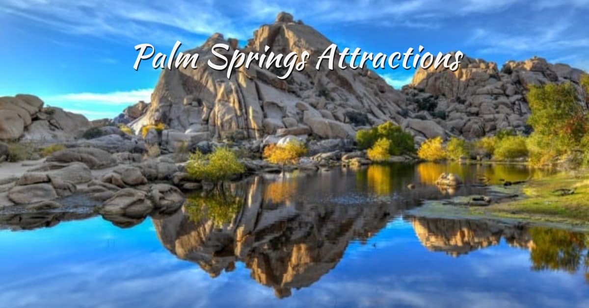
Best Hikes in Palm Springs: Top Hiking Trails for 2026
Palm Springs has this way of surprising you. At first, it looks like pure desert, flat and quiet. But step onto the trails, and suddenly there’s variety everywhere. Steep climbs, shaded canyons, easy walks, even palm-filled oases.
The hiking trails in Palm Springs offer something for every pace and mood, whether you want a quick morning walk or a full workout.
Best Hikes in Palm Springs CA and Popular Hiking Trails
If you’re exploring the best hikes in Palm Springs, a few names come up again and again. And for good reason, they deliver consistent views and well-maintained paths.
Popular choices include:
- South Lykken Trail for city views and moderate climbs
- Indian Canyons trails for palm groves and water features
- Tahquitz Canyon for a short hike with a waterfall payoff
These trails balance scenery with accessibility. You don’t need to be an expert, just prepared.
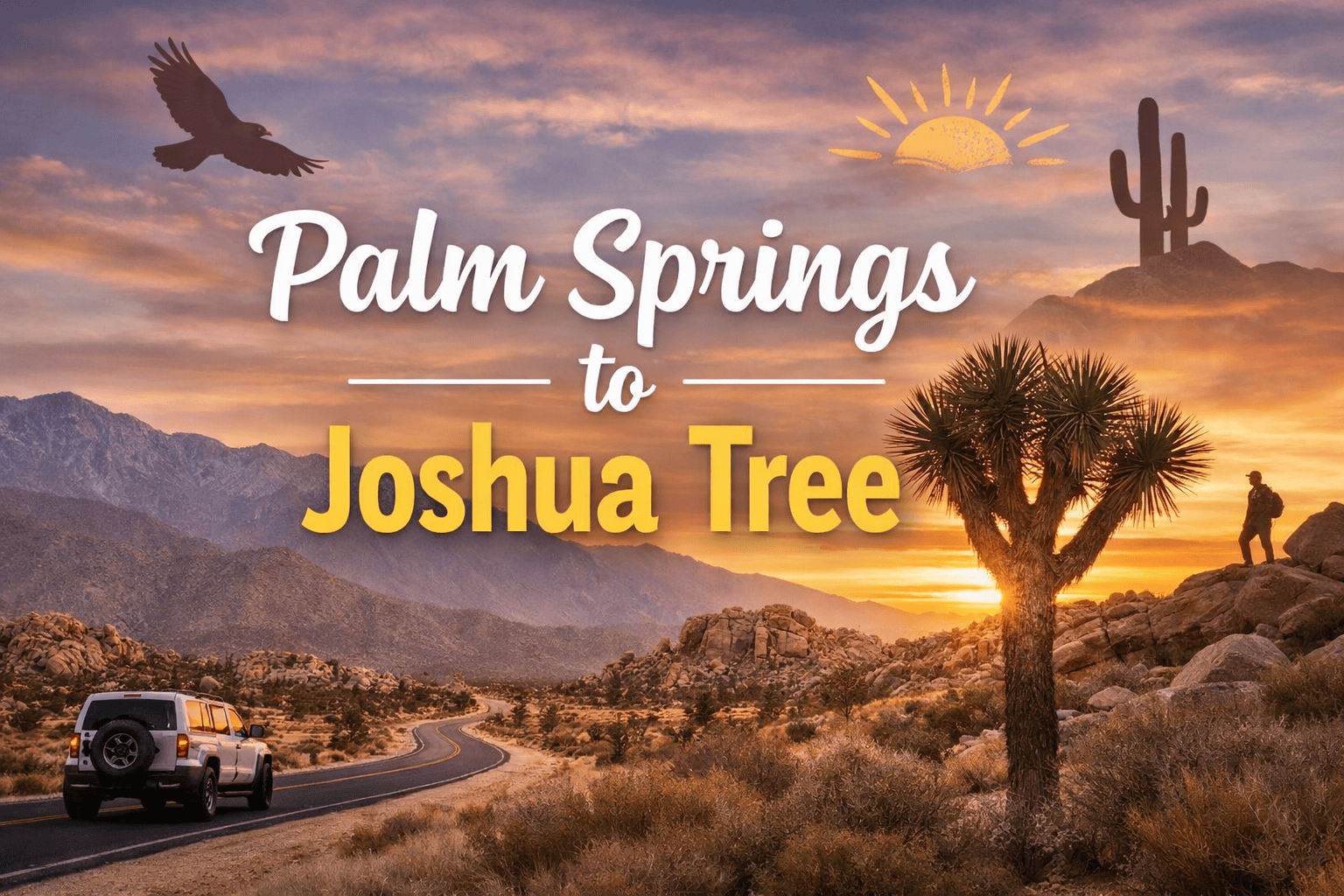
Hikes Near Palm Springs: Mount San Jacinto, Joshua Tree and Beyond
If you’re willing to drive a bit, the options expand quickly. The surrounding area offers cooler elevations and more diverse terrain.
- Mount San Jacinto State Park for alpine hiking
- Joshua Tree National Park for its unique rock landscapes
- Coachella Valley Preserve for quieter, less crowded trails
It’s interesting how quickly the environment changes. Desert floor to mountain forest in under an hour.
Easy Hikes in Palm Springs for Seniors and Beginners
Not every hike needs to be a challenge. Some are meant to be enjoyed slowly.
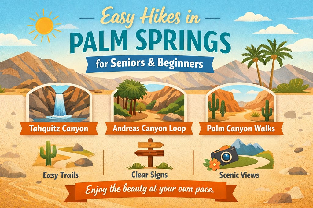
Sometimes, the easiest trails are the most memorable. You notice more when you’re not rushing.
Palm Springs Hiking vs Nearby Trails: How South Lykken Compares
Palm Springs hiking feels simple, open, and shaped by desert light. It’s not extreme, yet it delivers steady climbs and wide views.
Compared to other destinations, it sits comfortably in the middle, not too intense, not too easy.
South Lykken Trail vs Camelback Mountain: Difficulty Comparison
Camelback Mountain trail is steep, direct, and physically demanding from the start.
- Sharp elevation gain in a short distance
- High heat exposure with little shade
- Busy trails, especially on weekends
Compared to South Lykken Trail, the climb here feels more intense and less forgiving.
South Lykken Trail vs Zion National Park Hikes
The scale shifts dramatically here; Zion National Park has towering cliffs and narrow canyons.
- Iconic hikes with steep drop-offs
- Structured and well-marked routes
- Visually striking landscapes throughout
Compared to South Lykken Trail, this feels more dramatic and overwhelming.
South Lykken Trail vs Tecolote Canyon Trail: Desert vs Urban Hiking
Tecolote Canyon Trail is a much easier, more casual option.
- Flat, well-defined paths
- Urban setting with easy access
- Ideal for short walks
It lacks the elevation challenge of the South Lykken Trail but works well for relaxed outings.
Palm Springs Hiking vs St Lucia Trails: Desert Meets Tropical
St Lucia trails offer a lush, tropical contrast.
- Dense greenery and coastal views
- Humid climate with shaded paths
- More varied terrain
Compared to South Lykken Trail, the experience feels richer in vegetation but less open.
Hidden Gems and Lesser-Known Places to Hike in Palm Springs
Palm Springs is known for its iconic trails, but the real magic often sits just off the radar. Some paths are quieter, less crowded, and feel more personal.
You won’t always find them on top travel lists, but once you do, they tend to stick with you.
Where Are The Best Local Secrets And Hidden Gems In Palm Springs?
A few lesser-known spots offer a more peaceful hiking experience without sacrificing views.
Araby Trail: Quiet Desert Rock Formations
Araby Trail is:
- Quiet trail with unique desert rock formations
- Fewer hikers, especially on weekdays
Garstin Trail: Steep Climbs With Rewarding Valley Views
Garstin Trail is:
- Steeper sections with rewarding valley views
- Connects to other routes for longer hikes
North Lykken Trail Upper Sections: Solitude and Expansive Views
North Lykken Trail upper sections are:
- Less crowded than the lower trail access points
- Expansive views with more solitude
These trails feel more local. Less noise and more space to think.
Museum Trail, Oswit Trail Palm Springs and Palm Canyon Trail
If you want alternatives that are still popular but slightly less overwhelming, these are solid choices.
Museum Trail: Steep Climb Near Palm Springs Art Museum
- Starts near Palm Springs Art Museum
- Steep climb leading to panoramic viewpoints
Oswit Trail Palm Springs: Short Moderate Hike With Scenic Overlooks
Oswit Trail is:
- Shorter, moderate hike with scenic overlooks
- Good option for a quick outing
Palm Canyon Trail: Famous Palm Groves and Water Crossings
Palm Canyon Trail is:
- Famous for its palm groves and water crossings
- More shaded and diverse terrain
Each offers something different, but all share that classic Palm Springs contrast. Desert, yet full of life.
Don’t miss one of the most iconic spots, see Tahquitz Canyon CA: Ultimate 2026 Guide to 10 Stunning Trail Sites for breathtaking views and culture.
Hiking Near Me: Trails Near Me and Nature Walk Options in Palm Springs
Searches like “hiking trails near me,” “trail near me,” or “nature walk near me” usually come from a simple need.
You want something close, easy to access, and worth your time. No long planning, no complicated routes. Just step outside and go.
Palm Springs fits that need surprisingly well. The city is surrounded by trails that begin almost at street level, so you’re never far from a starting point.
Here’s why these trails work for all levels:
- Easy access from downtown and nearby neighborhoods
- A mix of short walks and moderate hikes
- Clear paths that don’t require technical skills
- Scenic views even on shorter routes
For beginners or casual walkers, options like canyon trails or flat desert paths offer a relaxed experience. For those wanting more, trails like South Lykken add elevation without becoming overwhelming.
It’s that flexibility that stands out. Whether you have one hour or a full morning, there’s always a trail nearby that fits. And honestly, that’s what most people are really searching for.
Dog Friendly Hikes Palm Springs and Outdoor Activities
Palm Springs isn’t just for hikers. It works well for dog owners, runners, and cyclists, too. The open desert layout and accessible trails make it easy to plan outdoor time without overthinking it.
Dog Friendly Hikes in Palm Springs: South Lykken and Beyond
Not every trail allows pets, but a few solid options stand out.
South Lykken Trail
- Dogs allowed on leash
- Wide paths with open views
North Lykken Trail
- Less crowded sections for calmer walks
Nearby dog parks add flexibility:
- Palm Springs Dog Park for off-leash play
- DeMuth Park for open space and walking paths
Always carry water. The desert heat builds quickly, even in the morning.
Best Biking Routes Near Me And Where To Run In Palm Springs
Palm Springs also suits cyclists and runners.
- Gene Autry Trail for long biking stretches
- Downtown loops for casual runs
- Indian Canyon area roads for scenic routes
You get variety without needing to travel far. Walk, ride, or run; it all fits here.
South Lykken Trail Latest Updates, Weather, and Safety Tips
Conditions on the South Lykken Trail can shift quickly, mostly due to temperature rather than terrain.
The trail itself stays consistent, but heat, sun exposure, and timing can completely change the experience. Checking current conditions before heading out helps avoid unnecessary risk.
South Lykken Trail Latest Reports and Current Conditions
Recent updates show the trail is stable and accessible.
- Clearly defined path with no major closures
- Rocky sections remain unchanged
- High sun exposure across most of the route
Hikers often note that the return hike feels harder, especially later in the day. The lack of shade makes timing more important than distance.
Palm Springs Weather: Best Season for Hiking Trails Nearby
The weather is the biggest factor when planning any hike here. As shown above, temperatures rise quickly after sunrise.
- Best season: October to April
- Ideal start time: Early morning
- Avoid hiking after late morning during warmer months
Even on mild days, heat builds faster than expected. Starting early is not just about comfort; it directly affects safety.
Where to Stay Near South Lykken Trail: Spirit of Sofia Boutique Hotel

Here’s the thing. If you want a hotel in Palm Springs CA that feels personal, not cookie-cutter, Spirit of Sofia lands just right. It’s small, design-forward, and quietly charming.
Think clean lines, soft desert tones, and that calm you only notice after a long drive.
Why Spirit of Sofia Works for Palm Springs Hikers
You wake up, grab coffee, and the trail is basically calling your name. The South Lykken Trailhead sits just minutes away, which means less planning, more walking.
- Quick access to South Lykken Trail
- Ideal for sunrise or late afternoon hikes
- Easy return without long drives
Comfort Meets Location
Honestly, location can make or break a trip. This one leans in your favor.
- Central Palm Springs setting
- Cozy rooms with modern touches
- Close to cafes, local shops, and essentials
So yes, it’s stylish. But more than that, it’s practical. And that balance? Hard to find.
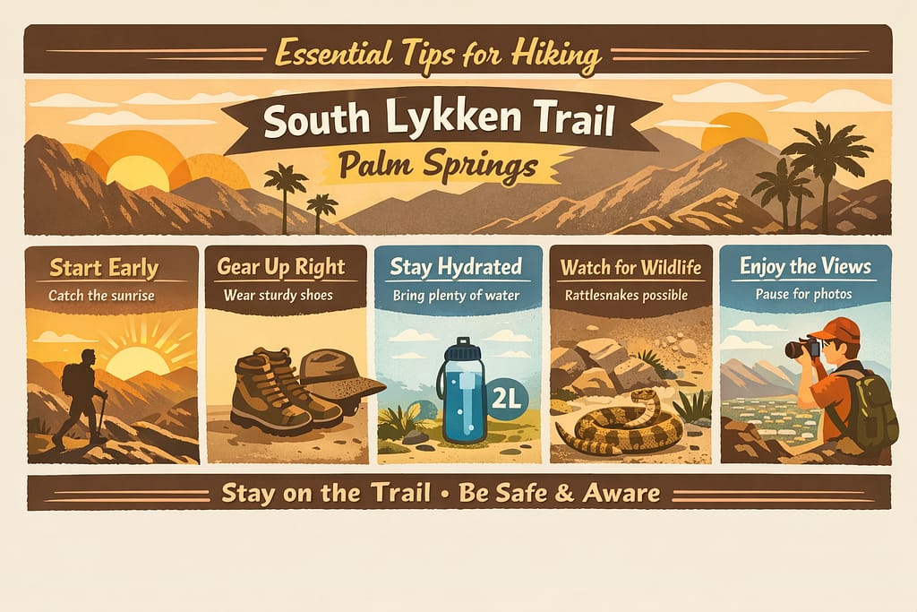
Essential Tips for Hiking South Lykken Trail Palm Springs
Let us explain. South Lykken Trail is beautiful, but it does not play nice with late morning heat. Palm Springs sun climbs fast, and it hits hard.
You hike for the view, after all.
Planning your hike? Check out Palm Springs Packing Tips: 15 Essential Travel Hacks (2026) to make sure you’re fully prepared for the desert.
Final Thoughts: Why South Lykken Trail Is One Of The Best Palm Springs Hikes
South Lykken Trail earns its place among the best hikes in Palm Springs CA, for a simple reason. It delivers more than you expect.
You get steady elevation, wide open desert views, and a quiet sense of escape that feels rare so close to town.
It is challenging, yes, but never overwhelming. That balance is what makes it memorable. If you are planning to explore Palm Springs hikes, this trail is a strong start.
And once you finish, you will probably want more desert trails, more sun, and more of that stillness.
FAQs | South Lykken Trail Palm Springs
1. What is the prettiest hike in Palm Springs?
The South Lykken Trail Palm Springs is often considered one of the prettiest hikes due to its panoramic desert views and scenic ridgelines. Trails like Palm Canyon also offer lush oasis landscapes for variety.
2. What is the hardest hike in Palm Springs?
The hike to Mount San Jacinto State Park via Skyline Trail is considered the most challenging due to its steep elevation gain. It’s best suited for experienced hikers with proper preparation.
3. What is the most beautiful trail in Point Lobos?
Point Lobos State Natural Reserve features stunning coastal trails like the Cypress Grove Trail with ocean views. It’s known for dramatic cliffs, turquoise waters, and wildlife sightings.
4. How long does a San Jacinto hike take?
A full hike up Mount San Jacinto can take 8–12 hours, depending on your route and pace. Many hikers use the tram to shorten the journey.
5. What is the 2 hour rule in Palm Springs?
The “2-hour rule” suggests finishing hikes early due to extreme desert heat after mid-morning. Starting at sunrise helps avoid dangerous temperatures.
6. When not to visit Palm Springs?
Avoid peak summer (June–August) when temperatures exceed 100°F, making outdoor activities difficult. Winter and spring are the best seasons for hiking.
7. Why do hikers eat gummy bears?
Gummy bears provide quick energy due to fast-digesting sugars, making them ideal for boosting stamina during hikes. They’re lightweight and easy to carry.
8. Is it cold at the top of the Palm Springs tram?
Yes, temperatures at Palm Springs Aerial Tramway can be 20–30°F cooler than the desert floor. It’s best to carry layers even on warm days.
9. Can you hike from Palm Springs to Idyllwild?
Yes, experienced hikers can take routes like the Skyline Trail to reach Idyllwild. It’s a long and strenuous trek requiring planning and endurance.
10. What season is trouble in Palm Springs?
Summer is the most challenging season due to extreme heat and dehydration risks. Hiking is safest from October to April when temperatures are milder.